
SIDUS
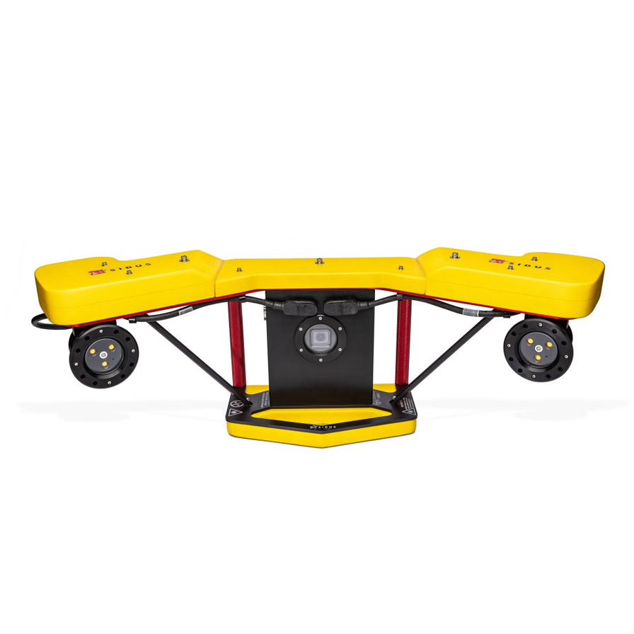
Video Laser Scan™ – MAYOL, A VLS™ 3D System
3D Mapping of Local Features
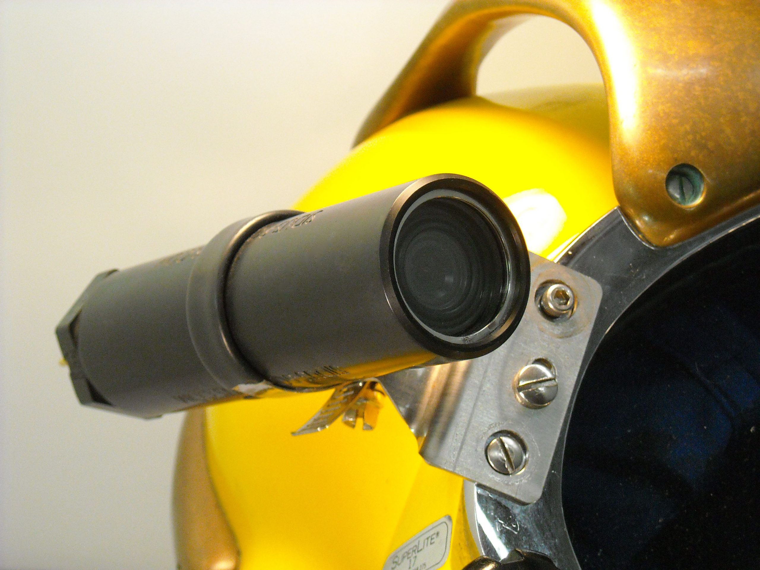
Whether you need to inspect a crack, a dent, a weld or any other kind of local features, the MAYOL Video Laser Scan™ System operated by divers will generate for you a 3D High Accuracy Point Cloud. From a standoff distance between 0.5m and 1m the diver shoots a video with laser, flying most of the time in parallel to the feature.
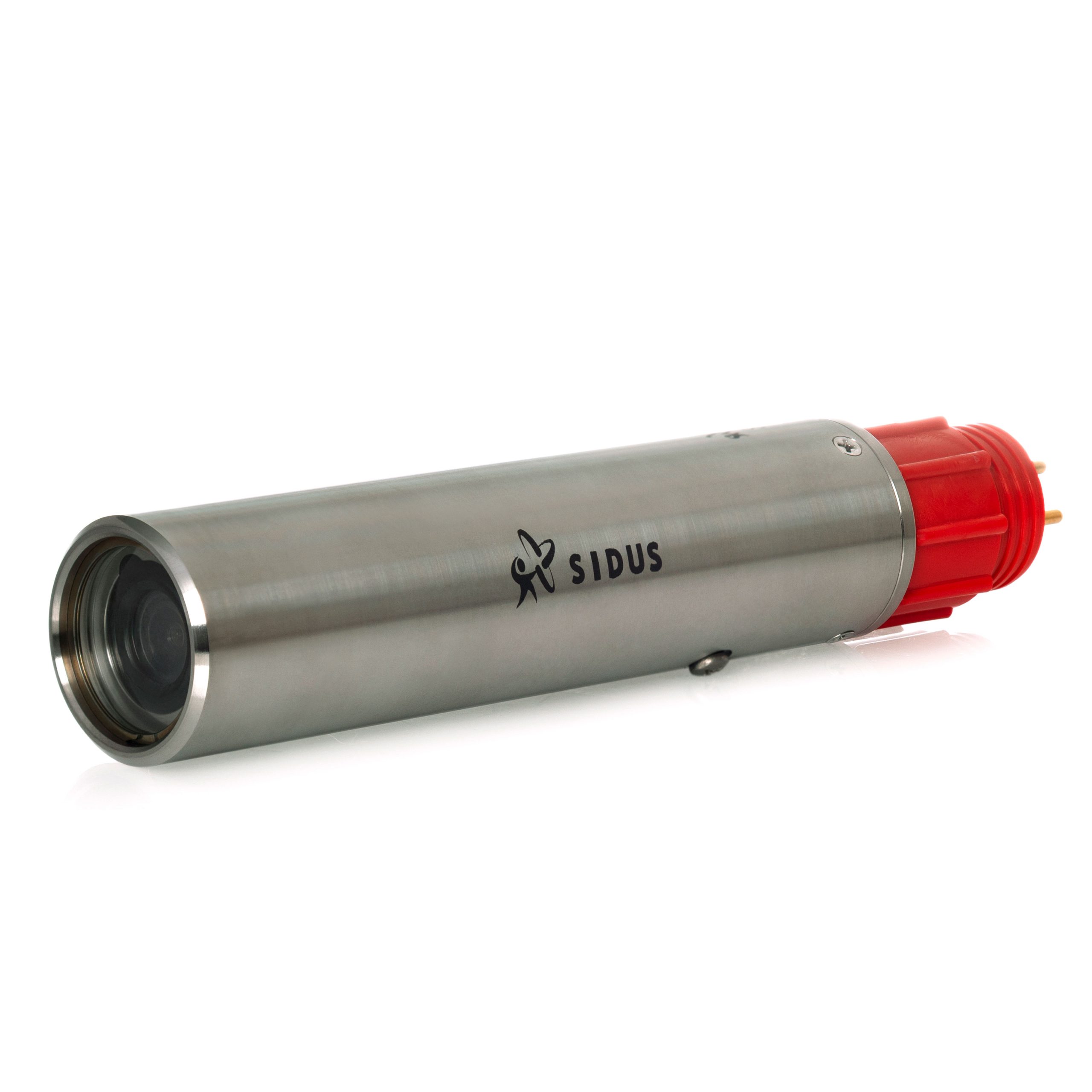
Data is recorded on an SD card and downloaded onshore for further processing.. When shooting at 4K and 30 images/second, (DimEye recommendation), 55 minutes of video can be recorded.
The MAYOL is a 3D Measurement Instrument. General dimensions as well as a 3D mesh/CAD give you all the dimensional info required for Integrity Management. The Point Cloud can also be used directly for FEA (Finite Element Analysis).
3D As-Built CAD Modeling
Most of the engineering projects such as modification or repair need to be based upon an accurate knowledge of the as-built. The MAYOL System operated by divers provides you with a full 3D As-built CAD Model of any Subsea Structure. From a standoff distance between 1 and 3 meters the diver shoots a video, turning around or flying above the structure.
The 3D As-built CAD Model is available in any format (.dgn, .dwg, .step, .igs, etc.). The camera user interface is the GoPro classic user interface, accessible through push buttons. The laser and the light user interfaces are on/off switches.
Related Products
SIDUS offers the widest range of camera stations and system solutions, we have the products and experience to meet today's demanding surveillance and security needs. With products available that are explosion-protected or weatherproof, analog or IP, fixed, dome or PTZ, our experience, and proven reliability can meet your specification requirements.
Need Help?
Three ways to Go SIDUS

Call
Ready to talk to a Sidus Rep

We'll back in touch within 24 hours

Book a Meeting
Pick your best day and time now